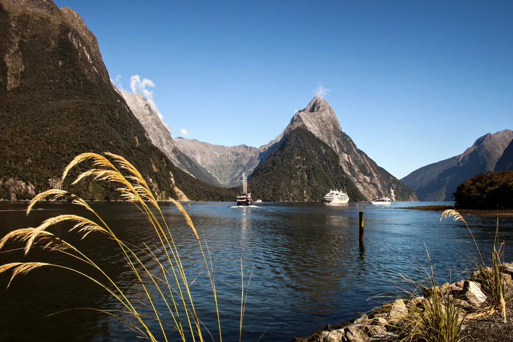
Picture a road that climbs through beech forest, passes a lake so still that it doubles the mountains, then drops through a tunnel in a granite wall and ends at the edge of the sea, where a single peak rises almost a mile straight out of the water. That is the drive to Milford Sound, and it is a fair summary of New Zealand's South Island: big landscapes, short distances between them, and very few people.
The South Island has about a quarter of New Zealand's population but most of its mountains, glaciers and fiords. December to February is summer there, which makes it one of the best escapes from a North American winter. Here is what to see, how the pieces fit together, and what to know before you fly.
Milford Sound and Fiordland
Fiordland National Park covers the southwest corner of the island and is part of Te Wāhipounamu, the South West New Zealand World Heritage Area. Its most famous fiord (the Māori name is Piopiotahi) is Milford Sound, where Mitre Peak rises 1,692 meters (5,551 feet) directly from the water and waterfalls pour down the cliffs after rain.
Most visitors take a boat cruise of one to two hours from the terminal at the end of the road. Rain is common here, and it is not a reason to cancel: on wet days hundreds of temporary waterfalls appear. The drive from Te Anau takes about two hours without stops, though you will want many, for example at the Mirror Lakes. Fill up with fuel in Te Anau, since there are no towns along the road, and check road conditions in winter and spring, when avalanche risk can close the road.
If you have more time, quieter Doubtful Sound is reached by boat and bus from Manapouri, and the Milford Track, one of the country's Great Walks, needs advance booking with the Department of Conservation.
Queenstown and the Southern Lakes
Queenstown, on the shore of Lake Wakatipu, is the island's activity capital: jet boats, bungy jumps, gondola rides, ski fields in winter and wineries in the Gibbston Valley. It is also the most practical base for Milford Sound day tours by coach or small plane. Thirty minutes away, Arrowtown keeps the gold rush era alive in a row of old shopfronts, and the autumn colors in April are famous.
Wanaka, an hour north over the Crown Range, is the calmer alternative: a lake town with walking tracks, a famous lone willow tree standing in the water, and easy access to Mount Aspiring National Park.
Aoraki/Mount Cook and the Mackenzie Basin
Aoraki/Mount Cook is New Zealand's highest mountain at 3,724 meters (12,218 feet), and the national park around it holds most of the country's highest summits. The best short walk is the Hooker Valley Track: about 6 miles (10 km) return, roughly three hours, mostly flat, with swing bridges over the glacial river and a lake with floating ice at the end.
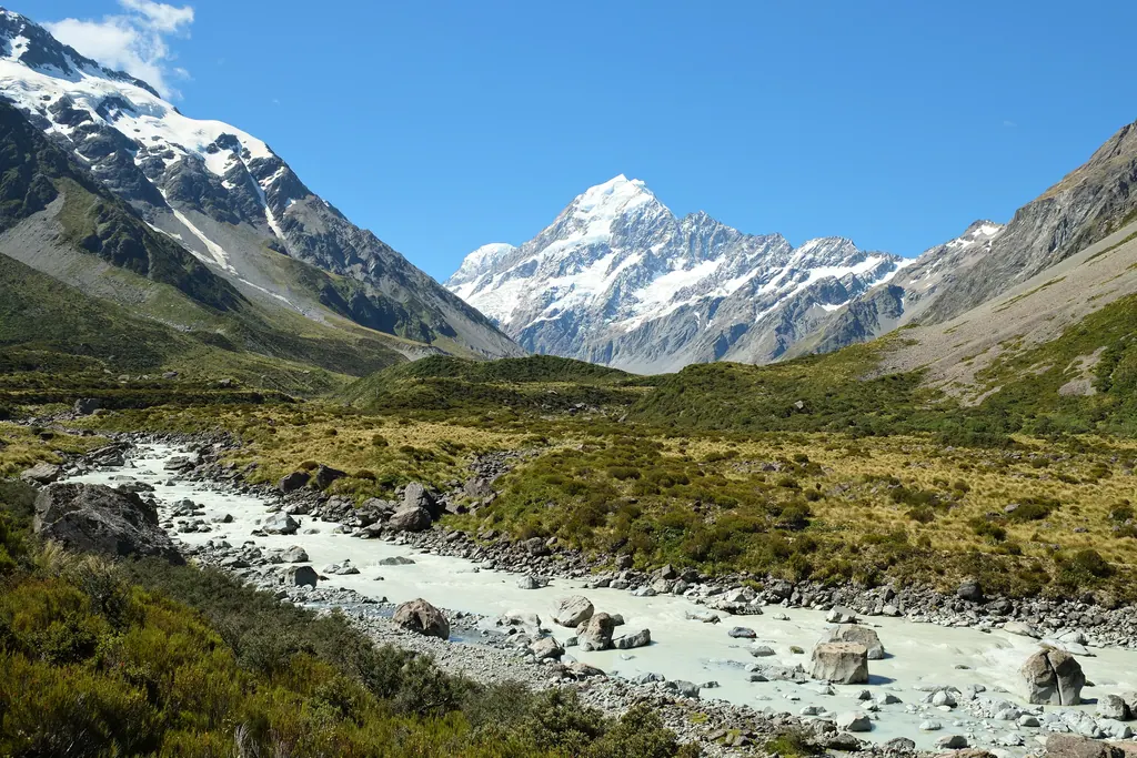
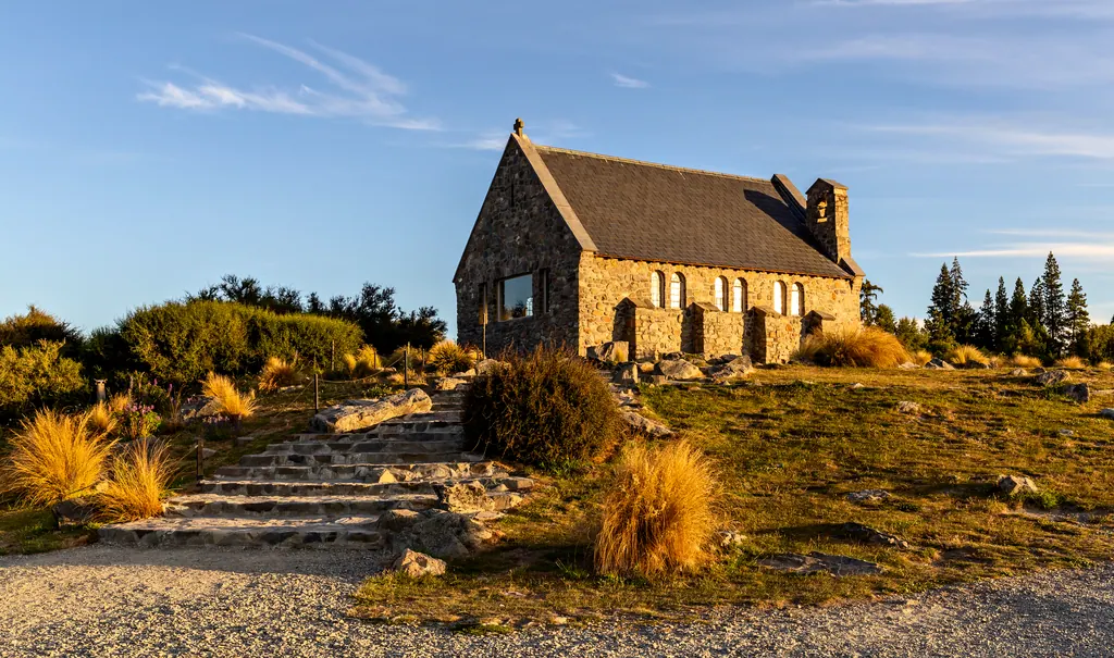
On the way, the turquoise lakes Pukaki and Tekapo get their color from fine glacial rock flour. Tekapo's small stone Church of the Good Shepherd, built in 1935, is one of the most photographed buildings in the country. After dark, the sky is the attraction: the Aoraki Mackenzie International Dark Sky Reserve, created in 2012, protects about 1,690 square miles (4,367 km²) of night sky, and the Milky Way can be remarkably clear.
The West Coast Glaciers
On the western side of the Southern Alps, the Franz Josef and Fox glaciers descend toward rainforest, only a few miles from the Tasman Sea. Both have retreated a long way in recent decades, so you can no longer simply walk onto the ice. The viewpoints are reached by short valley walks, and the only way onto the glaciers themselves is a helicopter flight, with landings on the snowfields above. Weather on the West Coast changes fast, so leave a spare day if a flight matters to you.
Abel Tasman, Kaikōura and the Top of the South
The northern end of the island is gentler. Abel Tasman National Park, near Nelson, is known for golden beaches and clear water, and you can combine walking sections of its coast track with water taxis and sea kayaks. On the east coast, Kaikōura is one of the best places in the world to see sperm whales from a boat, with dolphins, fur seals and albatrosses as a bonus. Marlborough, around Blenheim, is the home of New Zealand's sauvignon blanc.
Planning the Trip
Getting there: Air New Zealand flies nonstop to Auckland from several U.S. cities, and other carriers add seasonal routes. United has scheduled seasonal San Francisco to Christchurch flights for the 2026/27 southern summer, a convenient way into the South Island. Otherwise, connect in Auckland to Queenstown or Christchurch.
Entry: U.S. citizens do not need a visa for a visit, but you need an NZeTA before you fly. It costs NZ$17 in the official app or NZ$23 online, plus the International Visitor Conservation and Tourism Levy of NZ$100, so about NZ$117 to NZ$123 in total (about $65 to $68 in 2026). Apply only through Immigration New Zealand's app or website.
Driving: New Zealanders drive on the left, and many roads are narrow and winding, with one-lane bridges. Distances look short on a map but take longer than you expect. See our list of countries that drive on the left if this is your first time.
How long: Ten days lets you see Queenstown, Milford Sound, Aoraki/Mount Cook and Tekapo without rushing. Two weeks or more adds the West Coast and the north of the island.
When to Go
December to February brings the warmest weather and long evenings, but also the most visitors and the highest prices. March and April are our favorite months: settled weather, fewer crowds and autumn colors around Arrowtown and Wanaka. Winter (June to August) is for skiing and clear, cold mountain days, while spring (September to November) brings lambs, wildflowers and snow still on the peaks.
Pick a season, plan around three or four bases rather than a new bed every night, and leave room in the schedule for the weather. If you are combining New Zealand with the islands, our guide to the best time to visit Fiji covers the most popular stopover, and you can find more of the region on our Oceania page.
Frequently asked questions
Do Americans need a visa for New Zealand?
No visa is needed for a visit, but U.S. citizens must get an NZeTA before flying and pay the NZ$100 International Visitor Conservation and Tourism Levy, about NZ$117 to NZ$123 in total in 2026.
How many days do you need on the South Island?
About ten days covers Queenstown, Milford Sound, Aoraki/Mount Cook and Lake Tekapo. Two weeks or more lets you add the West Coast glaciers and the north.
What is the best time to visit the South Island?
December to February is warmest but busiest. March and April often bring settled weather, fewer visitors and autumn colors.
Can you drive from Queenstown to Milford Sound in a day?
Yes, but it is a long day of roughly four hours each way. Staying in Te Anau, about two hours from Milford Sound, makes the trip easier.