Vietnam is about 1,650 kilometers long from the Chinese border to the tip of the Mekong Delta, and that length explains most of what makes it tricky to plan. In the far north, terraced valleys sit below a 3,143-meter peak and winter nights can drop close to freezing. Halfway down, limestone mountains hide some of the largest caves on the planet. In the south, islands in the Gulf of Thailand have white sand and water warm enough for snorkeling in January.
You can see a lot of it in two or three weeks, but not all of it at its best in the same month. Here are the bays, mountains, caves and islands most travelers weigh up, with honest notes on crowds, costs and timing.
Why does the season depend on where you are?
| Region | Best months | What to expect otherwise |
|---|---|---|
| North (Hanoi, Ha Long Bay, Ninh Binh, Sapa, Ha Giang) | October-April for dry weather; September-October for golden rice | Hot, humid summers with heavy showers; cool, gray and often misty from December to February, cold in the mountains |
| Center (Phong Nha, Da Nang, Hoi An) | February-August | Heavy rain and flood risk from about September to December |
| South-central coast (Nha Trang, Mui Ne) | January-August | Nha Trang gets most of its rain from October to December; Mui Ne is drier year-round and windy from November to March |
| South and islands (Phu Quoc, Con Dao) | December-April | Rainy season from about May to October, with rougher seas on Phu Quoc's west coast |
The UK Foreign Office notes that tropical cyclones normally affect Vietnam's eastern coast from May to November, with flooding and transport disruption, so a typhoon can close Ha Long Bay to cruise boats or cut roads in the center at short notice. If you travel in that window, keep a spare day or two in your plan.
Ha Long Bay or Lan Ha Bay: which cruise should you pick?
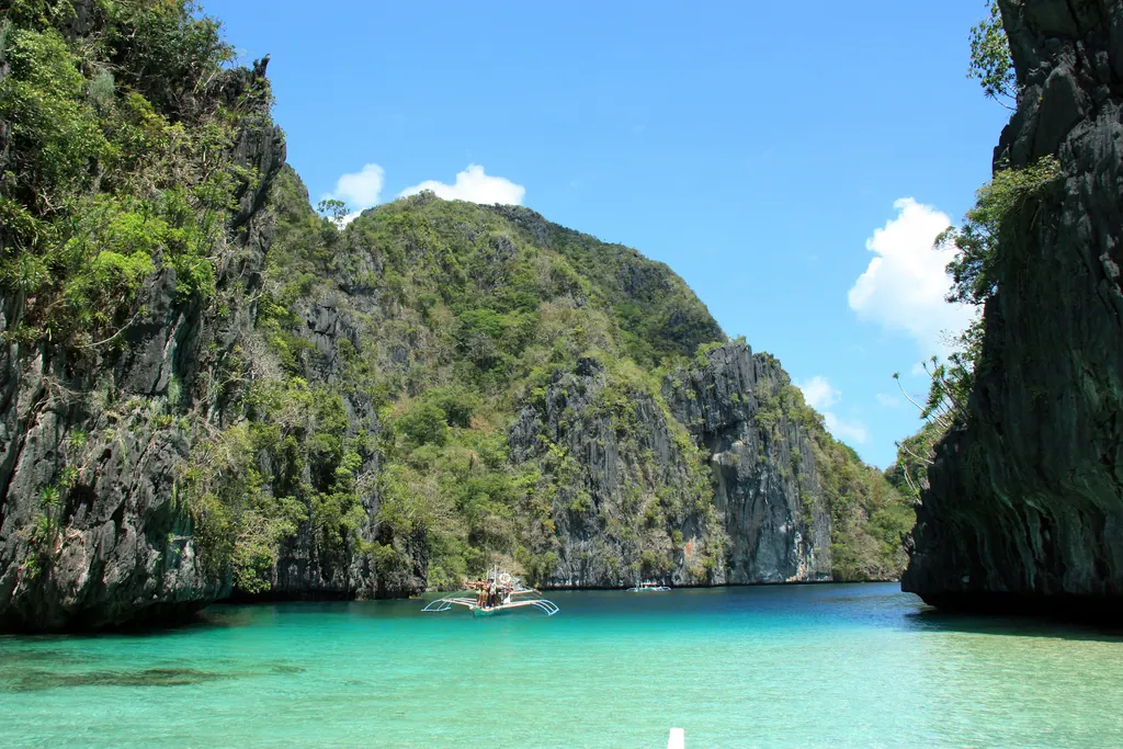
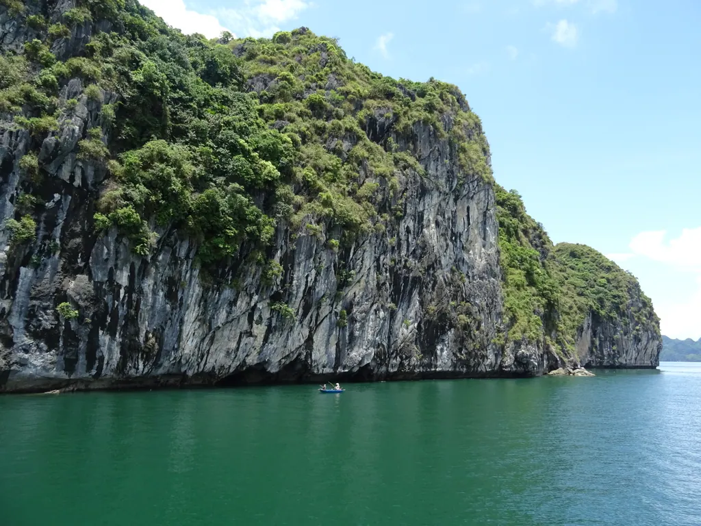
Ha Long Bay is the image most people have of Vietnam: hundreds of limestone towers rising out of green water. UNESCO first listed it in 1994, and in 2023 the site was extended to include the Cat Ba Archipelago, so it is now called Ha Long Bay-Cat Ba Archipelago. Together the two areas hold well over a thousand islets.
The choice that matters most is not which boat, but which part of the bay.
- Ha Long Bay proper is closest to the ports at Tuan Chau and Ha Long, with the most famous sights such as Sung Sot Cave and the viewpoint on Ti Top Island. It is also by far the busiest, and on a day trip you share the main routes with many other boats.
- Bai Tu Long Bay, to the northeast, has the same kind of scenery with noticeably fewer boats. Cruises here cost a little more and spend more time sailing.
- Lan Ha Bay, south of Ha Long and reached from Cat Ba Island or the port near Hai Phong, has small beaches tucked between the cliffs and is the best part of the area for kayaking. Cat Ba National Park on the main island is the only home of the critically endangered Cat Ba langur.
A day trip gives you a taste, but the transfer from Hanoi takes around 2.5-3 hours each way, so most travelers find an overnight cruise far more rewarding. Route fees are set by the province and depend on the route; in 2025-2026 a day route was around 250,000 dong (about $10) per person, usually included in what the cruise operator charges.
Price is a fair guide to safety, but not a guarantee. The UK Foreign Office advises checking a boat's registration and safety record and wearing a life jacket, since overcrowding and poor standards have caused accidents. Skip the very cheap overnight deals sold on the street in Hanoi.
Ninh Binh: is Trang An or Tam Coc better?
Two hours south of Hanoi, the Trang An Landscape Complex is often called "Ha Long Bay on land": rice paddies, rivers and limestone peaks, with boat trips that pass through caves so low you have to duck. UNESCO listed it in 2014 as a mixed cultural and natural site, partly for the evidence of human settlement in its caves going back tens of thousands of years.
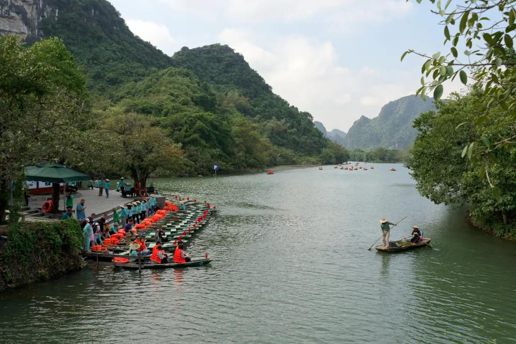
Trang An is the larger, more organized option. Boats are rowed by locals along one of three set routes of around two to three hours, passing several caves and temples. Around 250,000 dong (about $10) per adult was the standard ticket in 2026, and rowers rely on tips.
Tam Coc is the older, smaller route, famous for rowers who paddle with their feet. It runs through rice fields and three caves and is at its most photogenic when the rice is ripe in late May and early June. It is also more commercial, with vendor boats and pressure to buy on the way.
The climb of about 500 steps to the viewpoint at Mua Cave gives the best overview of the valley, and Van Long Nature Reserve, a quieter wetland nearby, is one of the few places to look for the rare Delacour's langur. Staying a night rather than coming on a day trip lets you be on the water before the tour buses arrive.
Sapa and the northern mountains: still worth the trip?
Sapa sits at about 1,500 meters in the Hoang Lien Son range near the Chinese border, in what is now Lao Cai province. The pull is the scenery: the Muong Hoa Valley, carved into rice terraces, and villages of Black Hmong, Red Dao, Giay and Tay people, many of whom still farm the slopes.
Sapa town has grown fast, with large hotels and constant construction, and the closest villages, especially Cat Cat, now feel more like attractions than farming communities. The classic day walk from Lao Chai to Ta Van is beautiful but busy. For the experience the photos promise, go further: two- or three-day treks with homestays in villages such as Ban Ho or Ta Phin, ideally with a guide from one of the local communities.
The terraces are green from about June to August and turn gold before the harvest, usually from mid-September into early October. December to February can bring frost and thick fog.
Mount Fansipan, at 3,143 meters the highest peak in Indochina, can be climbed in one or two long days with a guide, or reached by cable car. In 2026 a round-trip cable car ticket cost around 850,000 dong (about $33) for adults, and the summit area is a large, developed complex with temples and stairs rather than a wild mountaintop.
If Sapa's crowds put you off, the terraces at Mu Cang Chai and the market town of Bac Ha are quieter alternatives in the same region. Those who know rice terraces from elsewhere in Asia may also like our guide to volcanoes and rice terraces in the Philippines.
What is the Ha Giang Loop really like?
The Ha Giang Loop has become the north's big adventure: around 350 kilometers of mountain road along Highway 4C from the town of Ha Giang to Dong Van and Meo Vac, usually ridden over three to four days. The highlights are the Ma Pi Leng Pass above the Nho Que River and the Dong Van Karst Plateau, a UNESCO Global Geopark of bare gray limestone. In October and November, pink buckwheat flowers cover the fields.
Since July 2025, when Vietnam merged its provinces, the area has been administered by Tuyen Quang province, but the loop is still sold everywhere under the Ha Giang name.
Safety deserves more than a footnote here. Roads are steep, narrow and shared with trucks, and accidents involving foreign riders happen regularly. After a British tourist died on the loop in April 2026, provincial authorities tightened the rules for motorbike tours, banning unlicensed companies from selling tours and requiring licensed operators to provide maintained bikes, helmets and protective gear, according to Tuoi Tre News. Most visitors now ride on the back of a bike with an experienced local driver, known as an easy rider, which is the sensible choice for anyone who is not a confident motorcyclist. The UK Foreign Office says that riding yourself requires a 1968 international driving permit along with your national license, and you should check that your travel insurance covers motorbikes.
Phong Nha: which caves can you actually visit?
Phong Nha-Ke Bang National Park, in what is now Quang Tri province, protects one of the oldest karst landscapes in Asia. UNESCO listed it in 2003, and in July 2025 the site was extended across the border to include Hin Nam No National Park in Laos. The combined property has more than 220 kilometers of mapped caves and underground rivers.
Most visitors base themselves in the village of Phong Nha and see a few caves on their own:
- Phong Nha Cave, reached by boat along the Son River. Entry was around 150,000 dong (about $6) in 2026, plus a share of the boat fee.
- Paradise Cave, with a wooden walkway running about a kilometer into enormous, heavily decorated chambers. Expect to pay around 250,000-270,000 dong (about $10).
- Dark Cave, with a zipline, a swim into the cave and a mud bath inside. Muddy, fun and not for anyone who dislikes the dark.
The famous one, Son Doong, is the largest known cave passage in the world. It can only be visited on a multi-day expedition with the licensed operator Oxalis Adventure, which costs several thousand dollars per person, runs in small groups from about January to August and is often booked far ahead. Oxalis also runs shorter tours to caves such as Hang En and Tu Lan, which give a real taste of expedition caving for much less.
Which beaches on the central coast are best?
Da Nang has the easiest beach in Vietnam to reach from an international airport: My Khe Beach runs for kilometers along the city, with lifeguard stations, morning swimmers and a wide sandy strip. The Son Tra Peninsula just north of the city has forest roads and is home to red-shanked douc langurs, one of the most colorful primates in Asia. The waves can be strong outside the calm season, so swim where the flags say it is safe.
Hoi An, 30 kilometers south, is mainly about its old town, but An Bang Beach is a short bike ride away and has a more relaxed feel than Da Nang, with seafood restaurants and loungers on the sand. Nearby Cua Dai Beach has suffered serious erosion, so check recent photos before booking a hotel there. Boats from Hoi An go to the Cham Islands, a UNESCO biosphere reserve with modest snorkeling.
Nha Trang is Vietnam's classic beach city, with a six-kilometer arc of sand backed by high-rise hotels. It is busy, built-up and popular with group tours. The reason to come is the sea around it: boat trips go to Hon Mun, Vietnam's first marine protected area, for snorkeling and diving, and quieter bays such as Ninh Van lie a short boat ride away.
Mui Ne, on the south-central coast, is known for sand dunes and wind. The White Sand Dunes (Bau Trang) and the smaller Red Sand Dunes are usually visited on a sunrise or sunset jeep tour, and the steady winds from November to March have made Mui Ne one of Southeast Asia's main kitesurfing spots. Erosion has narrowed parts of the main beach, so Mui Ne is better for active travelers than for anyone who only wants to lie on the sand.
Phu Quoc or Con Dao for an island escape?
Phu Quoc is Vietnam's largest island, closer to Cambodia than to the Vietnamese mainland, and since the 2025 reform part of An Giang province. It has changed quickly: large resorts, an amusement park and a cable car to Hon Thom island now dominate the south. Even so, the beaches are among the best in the country.
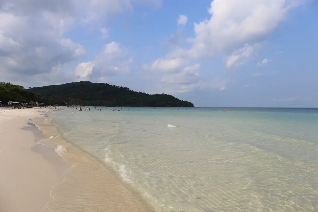
Sao Beach on the southeast coast has fine white sand and shallow, clear water. Long Beach on the west coast is the main hotel strip and the place for sunsets. In the north, Ong Lang and Ganh Dau are quieter. About half the island is covered by Phu Quoc National Park, more than 31,000 hectares of forest and coast that form the core of the Kien Giang Biosphere Reserve, with walking trails and streams that run best after the rains.
For snorkeling and diving, boats leave An Thoi for the An Thoi Islands at the southern tip. The water is clearest in the dry season, roughly November to April. The reefs are pleasant rather than world-class, and many travelers find the visibility lower than in Thailand or the Philippines.
Con Dao is the opposite. This small archipelago, reached by short flights from Ho Chi Minh City, has few hotels, empty roads and beaches such as Dam Trau, where planes land right behind the sand. Most of the islands are protected as Con Dao National Park, and Bay Canh island is one of Vietnam's most important nesting sites for green sea turtles. From roughly May to September you can book a night visit to watch turtles nest or a morning release of hatchlings through the national park office, in small groups. The islands also hold the former colonial prisons, a sobering part of the visit. Con Dao suits travelers who want quiet nature more than nightlife.
How to put it together
Picking one region in depth usually beats trying to cover everything. Some combinations that work:
- North in spring or autumn: Hanoi, two nights on Lan Ha or Bai Tu Long Bay, two nights in Ninh Binh, then either Sapa or the Ha Giang Loop. Aim for October for clear skies and ripe or freshly harvested rice.
- Center in spring or summer: Phong Nha for the caves, then Da Nang and Hoi An for beaches. Avoid October and November, when floods are common.
- South in winter: Phu Quoc or Con Dao from December to April, easily added to a trip that starts in Ho Chi Minh City.
The cooler highlands around Da Lat, with pine forests and hiking on Lang Biang mountain, make a good break between the south-central coast and the Mekong Delta. For more ideas, see our Vietnam destination page, our nature guides and our beach holiday articles.
Whatever route you choose, carry cash in dong: many ticket offices at caves, boat piers and national parks do not take cards, and fees change often enough that it pays to check the price at the counter rather than trusting an old blog post.
Frequently asked questions
Is Ha Long Bay worth visiting, or is it too crowded?
It is worth it, but the busiest routes near the main ports are crowded. An overnight cruise in Lan Ha Bay or Bai Tu Long Bay gives you the same limestone scenery with far fewer boats.
Can you swim in the sea in northern Vietnam in winter?
Not comfortably. From December to February the north is cool and often gray, and the sea in Ha Long Bay is cold. For beach weather in winter, head south to Phu Quoc or Con Dao.
Do you need a guide to trek around Sapa?
For short walks on main paths, many travelers go alone, but a local guide makes route-finding and homestays much easier on multi-day treks. The UK Foreign Office also recommends reputable guides for trekking in remote areas.
How long do you need for the Ha Giang Loop?
Most people take three or four days for the roughly 350-kilometer loop. Fewer days means long hours on steep mountain roads, which adds to the risk.
Where is the best snorkeling in Vietnam?
The An Thoi Islands off Phu Quoc, Hon Mun near Nha Trang and the waters around Con Dao are the main options. Visibility is best in the dry season, and the reefs are generally less spectacular than in Thailand or the Philippines.
- UNESCO World Heritage Centre: Ha Long Bay-Cat Ba Archipelago
- UNESCO World Heritage Centre: Trang An Landscape Complex
- UNESCO World Heritage Centre: Phong Nha-Ke Bang National Park and Hin Nam No National Park
- GOV.UK: Vietnam travel advice, safety and security
- Tuoi Tre News: Vietnam tightens safety rules on Ha Giang Loop motorbike tours
- Vietnam National Authority of Tourism: Kien Giang Biosphere Reserve