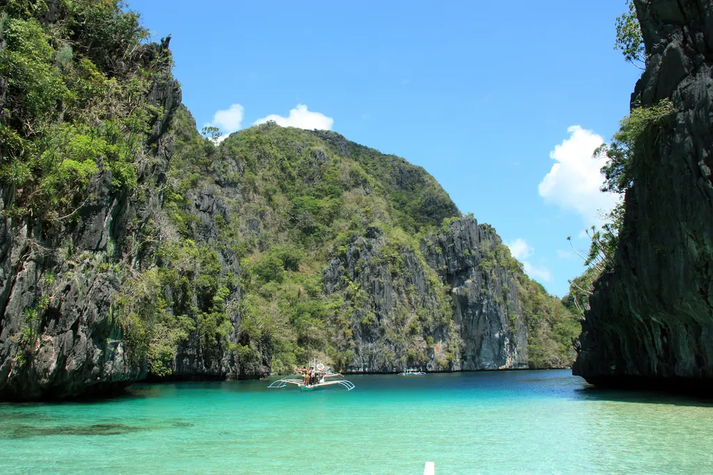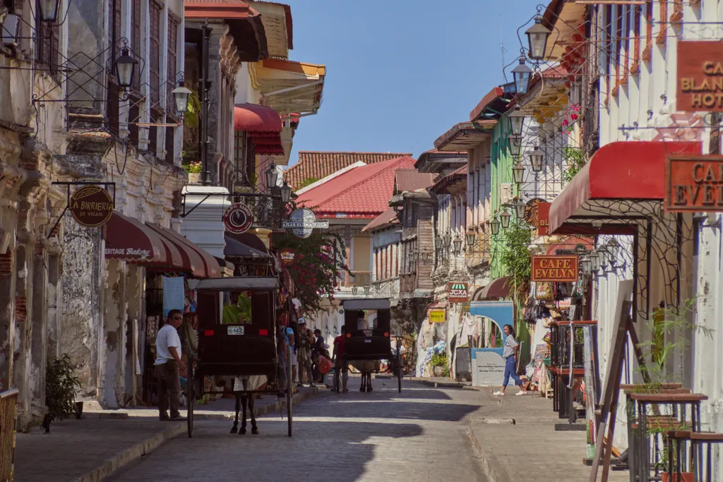
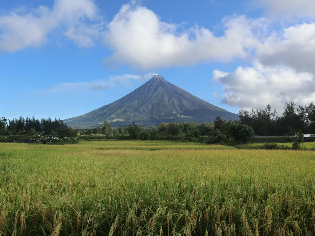
On a clear morning in Albay, Mayon Volcano looks almost too tidy to be real: a symmetrical cone rising about 2,460 meters straight out of rice fields, with a thin plume drifting off the summit. Far to the north, in the mountains of the Cordillera, farmers still work stone-walled terraces stacked hundreds of meters up the mountainsides. Neither scene fits the picture of white sand and island hopping that most people bring to the Philippines.
This is the other Philippines, the one of volcanoes, cool pine towns and long hikes. Below, we go through the places worth planning a trip around, from Mayon and Taal to the terraces of Ifugao, Sagada's caves, Mount Pulag and the small volcanic island of Camiguin, with what it takes to get there, when to go and what the fees looked like in 2025 and 2026. Prices are rounded at about 63 pesos to the US dollar. For festivals, food and the cultural side of the same regions, see our guide to culture and festivals in the Philippines.
How close can you get to Mayon?
Mayon is the most active volcano in the Philippines. The state volcano agency PHIVOLCS counts dozens of eruptions since records began in 1616, and the volcano has been restless again in 2026: the alert level was raised to 3 on January 6, 2026, after a collapsing lava dome sent pyroclastic flows down the slopes, and lowered to 2 on August 5, 2026, with PHIVOLCS stressing that magma was still stored beneath the volcano.
That restlessness shapes everything about a visit. A Permanent Danger Zone with a radius of 6 kilometers surrounds the crater, and entry is prohibited whenever the volcano is in unrest, which in practice is much of the time. Summit climbs, never easy because of loose rock, heat and gas near the top, are usually not allowed at all. ATV tours that run over old lava and lahar fields near Daraga and Camalig also depend on the current level.
The good news is that Mayon is a volcano you look at more than one you climb, and the views from outside the danger zone are superb:
- Cagsawa Ruins, Daraga. The bell tower of a Franciscan church that was destroyed in the eruption of February 1, 1814, which killed around 1,200 people. With Mayon behind it, this is the classic photo. Entry was a small fee of a few dozen pesos (under $1) in recent years.
- Lignon Hill, Legazpi. A short drive or a steep walk from the city, with a viewing deck looking straight across at Mayon and down over Albay Gulf.
- Sumlang Lake, Camalig. Bamboo rafts on a calm lake, with the volcano reflected in the water on still mornings.
The cone hides in cloud for much of the day, so go early. The months from about March to May are usually the driest and clearest in Albay, while the typhoon season runs roughly from June to November and the northeast monsoon brings rain to the Bicol coast around the turn of the year.
Getting there is easy. Bicol International Airport in Daraga has flights of about an hour from Manila, and overnight buses run from Manila to Legazpi in about 10-12 hours. Before you go, check the current alert level and advisories on the PHIVOLCS website. Never treat a level quoted in a guidebook, or here, as fixed.
What is the deal with Taal and Tagaytay?
Taal is the volcano most visitors see without really trying. It sits on an island in a lake that fills an enormous caldera, about 60 kilometers south of Manila, and the town of Tagaytay lines the caldera rim at roughly 600-700 meters. The ridge road gives a wide view over the lake, the volcano island and the far shore, and the altitude makes Tagaytay noticeably cooler than Manila.
The volcano itself is off limits. After the eruption of January 2020, Volcano Island has been treated as a Permanent Danger Zone, and PHIVOLCS has repeatedly said that entry to the island, especially the main crater, is strictly prohibited. Taal stayed at Alert Level 1 through much of 2026 but still produced small steam-driven eruptions, including two minor phreatic events at the main crater on October 18, 2026. Treat Taal as a view, not a hike, and check PHIVOLCS before a day trip.
Traffic decides the trip more than distance does. By car or bus, count on anything from 1.5 hours to well over 3 hours from Manila, and avoid weekends if you can.
Banaue or Batad: which rice terraces should you see?
The Rice Terraces of the Philippine Cordilleras were inscribed as a UNESCO World Heritage Site in 1995, and they spent 2001-2012 on the list of World Heritage in Danger. What surprises many visitors is that the famous terraces seen from the main viewpoint above Banaue town are not part of the listing. UNESCO chose five clusters in Ifugao province instead: Batad and Bangaan in the municipality of Banaue, Hungduan, central Mayoyao and Nagacadan in Kiangan.
Banaue is the base. The town itself is a jumble of concrete, but the viewpoints just north of it give the postcard view in minutes. Batad is the one to make time for. The village sits at the bottom of an amphitheater of terraces, reached by a jeepney or tricycle ride from Banaue to the end of the road, followed by a walk down of roughly 30-60 minutes on steps and paths. Many people stay overnight in simple village guesthouses, then hike on to Tappiya Falls, around an hour further, with a swim at the bottom.
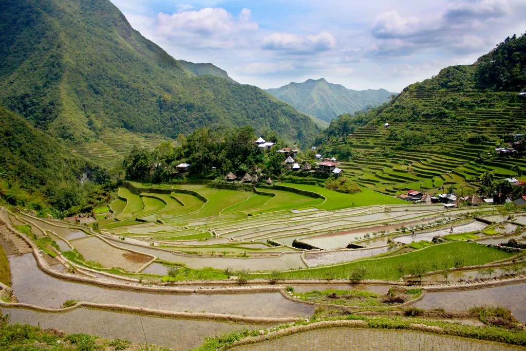
The terraces are fragile. A landslide triggered by Super Typhoon Fung-wong in November 2025 killed two people in Batad and destroyed part of a centuries-old irrigation canal, and in mid-2026 local officials were still asking for national funds to repair the damage. Some paths may be rerouted or closed, so ask at the Banaue tourism office before you set out, and stay on the walls and paths your guide uses. Banaue charges a small environmental fee on arrival, around 20-50 pesos (under $1) in recent years.
Overnight buses run by Coda Lines and Ohayami leave Manila in the evening and arrive in Banaue early the next morning, about 9-10 hours later. Fares were around 600-800 pesos (about $9.70-13) in 2025. The look of the terraces changes with the farming year: flooded and mirror-like after planting early in the year, greenest roughly from April to June, and golden near harvest in the middle of the year.
Why is Sagada so popular with hikers?
Sagada, in Mountain Province, sits at about 1,500 meters among pine forest and limestone ridges, a few hours from Banaue by way of Bontoc. It is cool, walkable and full of caves.
The main sights:
- Echo Valley and the hanging coffins. Wooden coffins fixed to the cliffs by the local Igorot community, a burial practice that still has meaning to families here. Stay on the trail, keep your voice down and do not touch or pose with the coffins.
- Sumaguing Cave. The big one, with smooth limestone formations, pools and slippery descents. The "Cave Connection" from Lumiang Burial Cave through to Sumaguing takes about 3-4 hours and involves ropes, wading and squeezing through narrow passages.
- Kiltepan, Bomod-ok Falls and Marlboro Hill. A sunrise viewpoint over a frequent sea of clouds, and longer walks through rice terraces and pine forest.
Sagada is strict about guides, and for good reason. Every visitor registers at the Municipal Tourism Office in town and pays an environmental fee (around 50 pesos, about $1, in recent years). The receipt doubles as your pass, so keep it with you. Caves, Echo Valley, the falls and most longer trails can only be visited with an accredited local guide booked through the tourism office, and some sites have daily visitor caps. Guide fees for Sumaguing have been around 500-800 pesos (about $8.10-13) for a small group, with the Cave Connection costing more. Caves close after heavy rain.
Coda Lines runs direct overnight buses from Manila to Sagada (roughly 12 hours). Alternatively, travel to Baguio first and continue by bus or van over the mountain road, or combine Sagada with Banaue on a loop through the Cordillera.
What does it take to climb Mount Pulag?
At 2,926 meters, Mount Pulag is the highest peak on Luzon. Its upper slopes are open grassland and dwarf bamboo, and its fame rests on the sunrise over a sea of clouds, when only the tops of neighboring ridges break through. The usual route starts at Ambangeg in Bokod, Benguet. It is a gentle trail that most reasonably fit hikers manage as an overnight trip with camping, followed by a predawn walk to the summit.
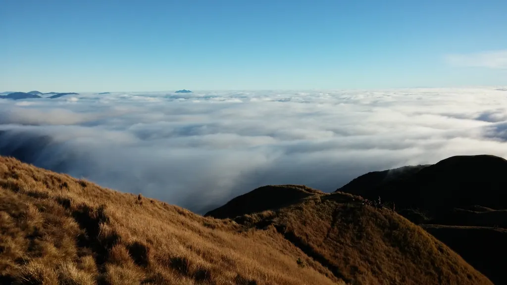
Pulag is a national park run by the Department of Environment and Natural Resources (DENR). Every hiker must secure a permit from the Protected Area Office at Ambangeg and attend an environmental orientation there before the climb, and a registered local guide is required. Foreign visitors pay a higher entrance fee than Filipino residents, and guide and local government fees come on top. Fees have changed several times, so confirm current rates and book ahead, because daily numbers are capped and holiday weekends fill up.
Do not underestimate the cold. On clear nights between December and February, temperatures near the summit can drop to around freezing. Most people travel via Baguio, from where the trailhead is a few hours by hired van.
Is Camiguin worth the detour?
Camiguin is a small round island off the north coast of Mindanao, often described as having more volcanoes than towns. Here, unlike at Mayon and Taal, you can walk, swim and soak in the volcanic landscape.
Mount Hibok-Hibok (about 1,330 meters) is the island's active volcano. Its eruptions between 1948 and 1953 included a deadly one in 1951, and it has been quiet since. The climb from the Ardent Hot Springs area in Mambajao takes roughly 3-4 hours up through forest to the crater rim. It is steep and often muddy, and you need a local guide and registration with the protected area office. Mount Vulcan is a younger cone that rose from the ground in the 1870s. The same activity sank part of a town, now marked by the large cross of the Sunken Cemetery offshore. Hot springs, waterfalls such as Katibawasan and a coastal ring road fill two or three relaxed days.
Most visitors arrive by ferry from Balingoan in Misamis Oriental to Benoni, a crossing of about an hour, after flying into Cagayan de Oro. There are also limited flights to Camiguin's small airport.
When to go and what to pack
The Philippines has a broad dry season from about December to May and a wet season from about June to November, when typhoons can close roads, cancel ferries and set off landslides in the mountains. For the Cordillera, the dry months are the safest choice for road travel and hiking. December to February brings the coldest nights and the best seas of clouds, while March to May is warmer and busier, especially around Holy Week.
| Destination | Typical base | Guide needed? | Pack |
|---|---|---|---|
| Mayon | Legazpi | For ATV and lahar tours | Sun hat, water, rain shell |
| Taal | Tagaytay | No (island off limits) | Light layer for the cooler ridge |
| Batad and Banaue | Banaue or Batad village | Recommended | Shoes with grip, rain jacket |
| Sagada | Sagada town | Yes for caves and most trails | Fleece, shoes or sandals you can get wet |
| Mount Pulag | Baguio | Yes, plus orientation | Down or fleece jacket, gloves, headlamp |
| Camiguin | Mambajao | Yes for Hibok-Hibok | Light hiking gear, swimwear |
A few practical notes for all of these places:
- Pack layers. A light fleece, a rain jacket and a warm hat cover most situations, from lowland heat to a cold summit.
- Footwear matters more than fashion. Terrace walls and cave floors are slick. Hiking shoes with a good sole, or sturdy sport sandals for the caves, are better than sneakers.
- Dress modestly in villages. Cover your shoulders and knees around homes, churches and burial sites, and ask before photographing people.
- Carry cash. Do not count on ATMs in the mountain villages, and most fees, guides and guesthouses are paid in pesos.
Volcano and weather warnings change fast. Before each leg of the trip, check PHIVOLCS for volcano bulletins and PAGASA, the national weather agency, for typhoon warnings, and read the current UK travel advice for the Philippines. Travel insurance that covers hiking is worth checking before you book; our travel tips cover the basics.
Putting it together
With a week, the most rewarding route for most people is the Cordillera: an overnight bus to Banaue, two nights in Batad, then on to Sagada for three or four days before returning to Manila via Baguio, adding Pulag if you have two extra days and the right clothes. With ten days or more, fly south to Legazpi for Mayon's viewpoints, then finish on Camiguin or on the beaches, which never lie far away. If long mountain days appeal, read our guide to trekking in Nepal next, and find more ideas under nature, active holidays and all our Philippines coverage.
Frequently asked questions
Can you climb Mayon Volcano?
Usually not. A 6 kilometer Permanent Danger Zone surrounds the crater, and entry is prohibited while the volcano is in unrest, which has been the case for much of 2026. Enjoy Mayon from viewpoints such as the Cagsawa Ruins and Lignon Hill instead.
Can you visit Taal Volcano Island?
No. PHIVOLCS treats Volcano Island as a Permanent Danger Zone and has repeatedly said that entry is strictly prohibited. The best views are from the Tagaytay ridge.
Are the Banaue Rice Terraces a UNESCO World Heritage Site?
Not the terraces at the main Banaue viewpoint. The UNESCO listing from 1995 covers five clusters in Ifugao: Batad, Bangaan, Hungduan, Mayoyao and Nagacadan.
Do you need a guide in Sagada?
For the caves, Echo Valley, Bomod-ok Falls and most longer trails, yes. Register at the Municipal Tourism Office, pay the environmental fee and book an accredited local guide there.
How cold does it get on Mount Pulag?
On clear nights between December and February, temperatures near the summit can fall to around freezing. Bring a warm jacket, gloves, a hat and a sleeping bag rated for cold nights.
- PHIVOLCS, Philippine Institute of Volcanology and Seismology
- PHIVOLCS downgrades Mayon Volcano alert status to Level 2, Manila Bulletin
- Rice Terraces of the Philippine Cordilleras, UNESCO World Heritage Centre
- President Marcos urged: Save disaster-hit Batad rice terraces, Philstar
- Sagada braces for tourists influx; issues guidelines, PTV News
- Philippines travel advice, GOV.UK